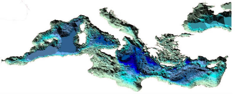
The TIN (Triangular
Irregular Network) of the whole sea floor for the Mediterranean Sea
-
Black Sea excluded - with a precision of 20 meters
derived from bathymetric data set
(polylines, points and
grid) through a specific tool (ESRI-Spatial Analyst)